From landscape data to ecological intelligence

TerraViso provides a structured environment for bringing spatial evidence together, developing a habitat baseline and using that baseline to understand the wider ecological landscape.
It combines high-resolution imagery, environmental data, reference information and spatial analysis within a workflow designed to keep evidence, professional judgement and quality assurance connected.
One landscape. One connected workflow.
Environmental analysis often involves moving between imagery, GIS datasets, habitat surveys, spreadsheets, models and reports. Each may provide useful information, but the connections between them can easily become fragmented.
TerraViso brings those stages together within a structured workflow. The evidence used to understand a landscape remains connected to the habitat baseline, the ecological analysis that follows and the decisions that analysis is intended to support.

The TerraViso workflow
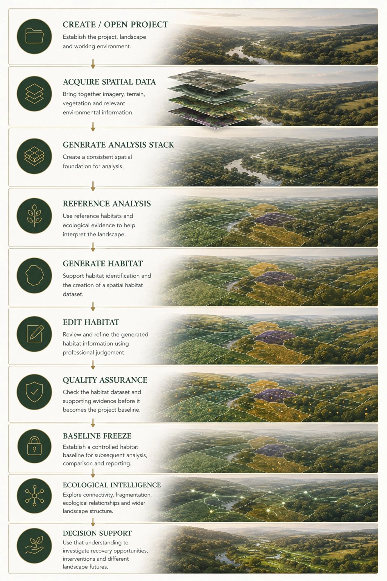
From project to decision support
Build from the evidence
Automation supports the workflow. It doesn't replace judgement.
Automation supports the workflow. It doesn't replace judgement.
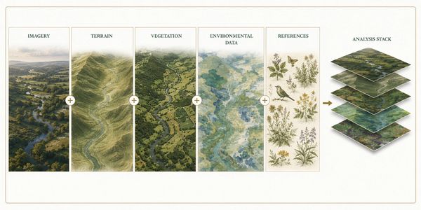
- TerraViso begins with the landscape itself.
- High-resolution imagery can be combined with terrain, vegetation and other environmental information to create a consistent analysis stack.
- Rather than treating these datasets independently, TerraViso uses them together to build a richer spatial description of the landscape.
- Reference information can then provide ecological context, helping the platform interpret patterns within that evidence and support subsequent habitat analysis.
Automation supports the workflow. It doesn't replace judgement.
Automation supports the workflow. It doesn't replace judgement.
Automation supports the workflow. It doesn't replace judgement.
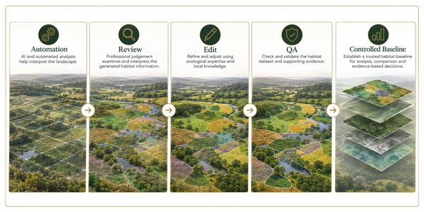
- TerraViso uses automation to help interpret complex spatial information and support habitat production, but generated outputs are not treated as unquestionable results.
- Habitats can be reviewed, edited and quality assured before they become part of the controlled project baseline.
- This distinction matters. AI and automation can help process evidence and identify patterns at scale, while ecological knowledge and professional judgement remain essential to interpreting what those patterns mean.
Establish a baseline. Then ask more of it.
- Once the habitat dataset has been reviewed and quality assured, TerraViso can establish it as a controlled baseline.
- That baseline provides a consistent point of reference for subsequent ecological analysis, comparison, monitoring and reporting. It can also support established frameworks such as Biodiversity Net Gain where appropriate.
- More importantly, it gives TerraViso a foundation from which to examine the landscape beyond individual habitat polygons.
Move from habitat information to landscape understanding

- TerraViso's Ecological Intelligence capabilities examine the relationships that exist across the landscape.
- Connectivity, fragmentation, neighbouring habitats, environmental characteristics and wider spatial patterns can help reveal how individual habitats contribute to a larger ecological system.
- This creates the opportunity to move from describing the landscape towards understanding how it functions — and where change might have the greatest effect.
Learning from ecological reference
Landscapes change. The evidence needs to change with them.
Landscapes change. The evidence needs to change with them.
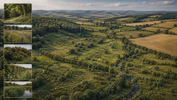
- Behind the workflow sits TerraViso's growing Knowledge Platform.
- Reference habitats provide examples of ecological characteristics that can be compared with new landscapes. TerraViso uses this evidence to support habitat interpretation and to explore similarities and relationships that may not be apparent from conventional mapping alone.
- This approach underpins TerraViso's developing Ecological Fingerprint Intelligence.
Landscapes change. The evidence needs to change with them.
Landscapes change. The evidence needs to change with them.
Landscapes change. The evidence needs to change with them.

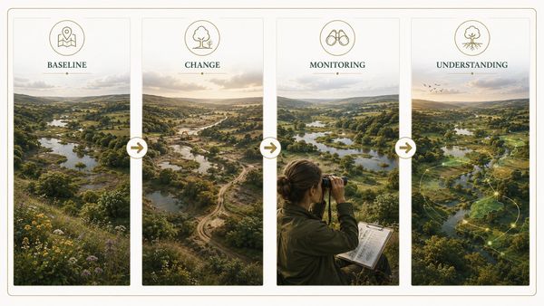
- A TerraViso project is not intended to be a snapshot that disappears into a report.
- A controlled baseline creates the opportunity to compare future surveys, examine ecological change and understand how management, development or restoration may be influencing the landscape.
- Over time, this provides the foundation for monitoring not simply whether something changed, but whether the ecological structure of the landscape is changing too.

What could TerraViso help you understand?
The same platform can support different questions across conservation, ecological consultancy, land management, planning and development.
The workflow remains consistent. What changes is the question being asked of the landscape.